Most people know that the whole reason I started Texas River Bum was that when I moved out to Austin in 2010, I was appalled at the lack of information available regarding the Texas Hill Country Rivers. I searched online and in bookstores but didn’t find much. Undeterred and perhaps somewhat out of spite, I decided to explore ALL OF IT on my own. I made a well thought out 5 year plan and presented it to my wife who immediately asked me, “if I was so ticked off that there was no information, why I wasn’t doing anything about it? Especially since I was determined to go out and explore it all myself anyhow”.
Okay, so strictly speaking maybe Texas River Bum wasn’t really my idea.
This is where the adventure really begins! The website was setup, poorly at first but at least it was online. A bunch of gear was acquired; from a tandem kayak to a DSLR camera. Finally in April of 2011 my daughter and I started exploring, or “surveying” as we called it. The Blanco River was our first target and we were so excited over how fun this was going to be. Our first day was April 4th and we spent it driving along the entire length of the river exploring every road on the map to verify if they were public or private. All the water crossings were photographed and cataloged. It was interesting at times but mostly tedious. We ached to actually get on the water and start the real fun.
Spoiler: surveying may be an adventure but it is definitely NOT fun.

On April 17th we finally put the kayak in at Crabapple Crossing where (we hoped) the river first becomes legally navigable. I wasn’t following the flow gauges yet so I didn’t know that the flow had dropped from 35cfs to 25cfs in the last 11 days. The day began with us dragging the kayak after us as we sloshed our way through ankle deep water.

Even though the river clearly met Texas state law’s guidelines for navigation, we had only gone 1.3 miles before a landowner told us that we were trespassing, the first of many we would encounter over the next month. This was followed by his fence crossing the river at mile 1.7 – where we had only been able to paddle about 25% of the distance. Yeah, we were having some fun. Luckily the river tended to get a little deeper as we went on and in a couple of miles we started down a chain of small lakes (large pools really) that cluster around the town of Blanco. Paddling was relatively easy and we made great time all the way until Linderman Crossing at mile 8.8 where the last pool ended.

The river was extremely shallow again and so we starting dragging the boat once more. Funny, I remember us actually carrying the boat back then, especially over places where it might get scraped. I don’t know why we were so gentle with it, maybe because it was new. More likely because we weren’t jaded yet. That would change. Anyway, we made 14.5 miles that day, all the way to Cox Crossing just as the sun was setting. We thought the river had taught us a little humility but in reality that lesson was still to come. However, I did learn to not leave the Jeep lights on all day and expect it to start. (thank you for the jump, Hays County Deputy)

We weren’t able to resume our survey until the 8th of May. The flow gauge in Wimberley was now down to 20cfs but we had ambitions to paddle over 20 miles this day. We put in 5 miles before the river literally dried up completely about .25 mile past the 2nd Chimney Valley Crossing. We left the kayak and hiked another mile to confirm it. Yep, dry as a bone.

Well, crap.
I figured it would rain at some point. I mean, it was springtime after all. So we moved operations downriver to where we could confirm flowing water. The flows were still holding at 20cfs on May 15th when we put in at Bendigo Crossing late in the afternoon. We paddled about 1.5 miles and camped for the night, positioned for a 2 full day trip.

The first day went surprisingly well, we only made a little over 14 miles despite the early start and there was a lot of boat dragging but on the other hand we discovered that Burger Barn is only a .3 miles from the river and so grabbed a couple of chili-cheese burgers as we passed through Wimberley.

Day 2 was another story. It started out the same as the first day until we hit the mile long lake/pool downriver of Halifax Ranch where we had to bushwhack our way Indiana Jones style though bushes laden with billions of spiders.

Okay, that part was fun since I got to watch Jaz live out her worst nightmare. But what came next could have been avoided if I had known to check the gauge at Lime Kiln Crossing which read zero-cfs.

Yeah, the river went dry again. This time it happens precisely 26.1 miles into our trip with 7.5 miles to our pull out. So we hump all our gear along the riverbed for 1.5 miles where a little water starts up again, return and get the kayak to carry it the same 1.5 miles. Fun, hurray! By now the day is late and we don’t get to the pull out until well after dark.
This is probably where I should have put aside surveying until the drought passed but I have been described as stubborn to the point of stupid.

By now I had discovered the USGS flow gauges and disheartened to see that the flow was down to 8cfs at Wimberley on May 22nd. Never-the-less we put in at Valley View Crossing to pick up the 9.1 miles between it and Bendingo Crossing. I guess because we had been in such a brutal trip the week before, this paddle was turning out to be relatively pleasant.

Sure we had to drag the kayak a lot but at least there was some water in the river at all times. We even discovered the Green Mile during this survey, a section of river that would end up as my favorite fishing grounds over the summer. At the end of the day, we had completed all but what we now knew of as the “Dry Blanco”, a section of the river that starts drying up whenever the water flow at Wimberley drops below 70cfs. I figured we would get some rain at some point over the next month and we’d paddle it then.
I was wrong; we did not get any real rain at all as the months went by.
So it was on September 22nd Jaz and I set out to hike the Dry Blanco. The gauge in Wimberley had been sitting at 5cfs for months now during the single driest year in Texas’ recorded history. I figured that if there was a time you could hike this section, this would be it.

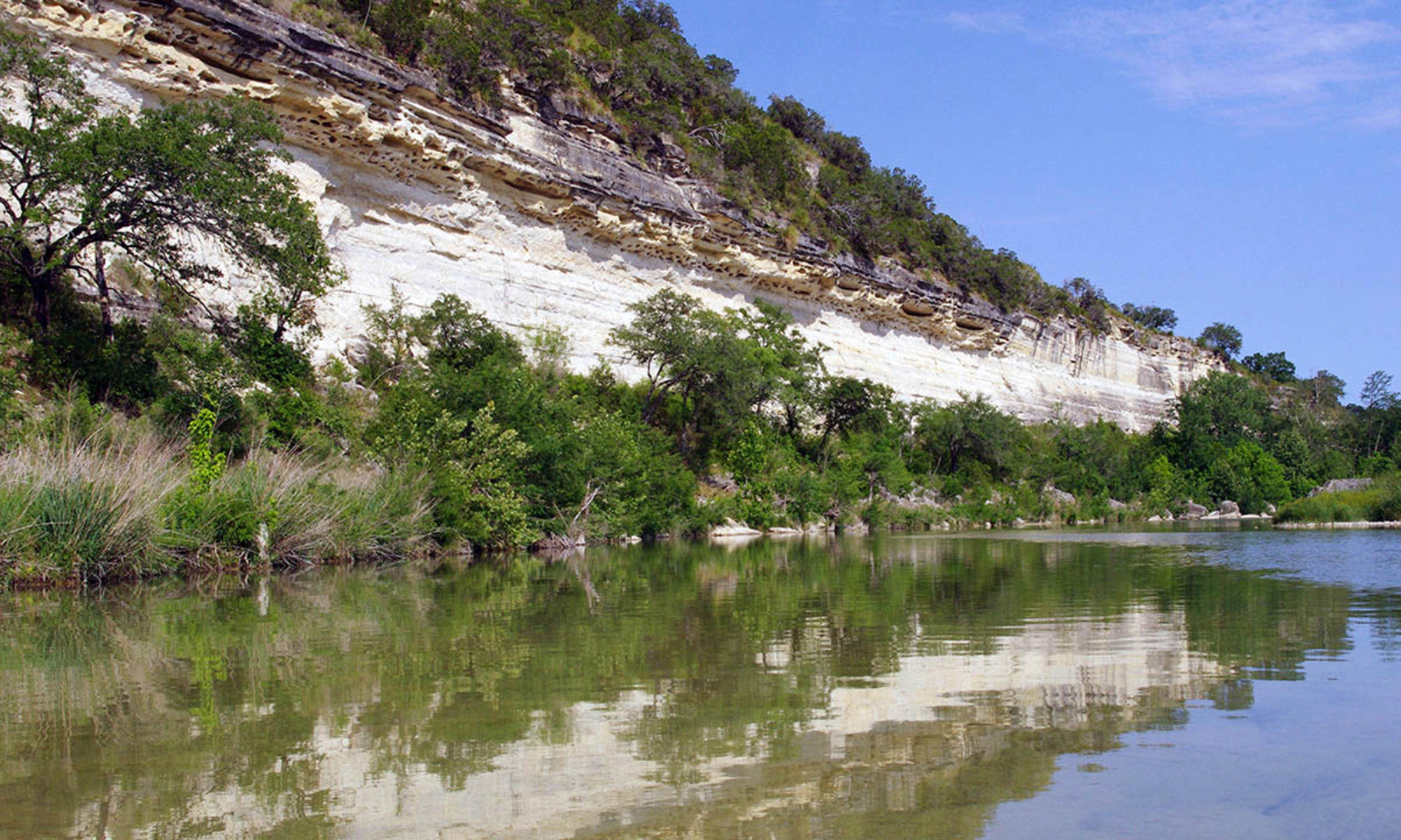
Despite being miserably hot, it was probably the best survey trip yet. Our packs were light and we made the 13.6 miles in good time while getting a chance to see The Narrows along the way.

The dry summer had been vile on the rivers and to my psyche. I did a lot of fly fishing over the summer and as interesting as the hiking survey of the Dry Blanco had been, it was also a bit depressing to think that the entire river could look like that if it didn’t rain soon. So here I was sitting on all the data to develop a guidebook for the river but I put the project aside, rationalizing that I was just waiting to see if it rained soon.
It did rain in November, not enough to restore the rivers but it sure did breath life back into them. Yet, I still felt dishearten about creating the guidebooks. I focused on work instead, dealing with a particularly depressing project with an impossible client. I let the website go for long periods without any updates and avoided the guidebook project for months. Looking back, I’m not entirely sure what was going on with me. I guess I lost belief that the guides would sell well enough to make them worth my while to pursue.
It was February of this year when I came out of my funk so to speak. It was raining in earnest and the long range prediction for the spring/summer was that we were going to have a normal year of precipitation. I even started to see whitewater kayaks heading out to the rivers and by March I was starting to get really excited about the Hill Country Rivers again.

My wife, Kelly got involved and started working on the maps and layout while I developed a style guide and worked on the technical data. Like most projects worth doing right, it always takes 10 times longer than you thought it would. But as it started to take shape I was getting more and more eager to get it out there to the world! People who have worked with me know that I am highly critical of how spatial information is presented; it’s just always been a thing with me. As this guide was finally coming to fruition I started to realized that I had created the perfect river guide for me. I don’t know how anyone else will feel about it but I can say that I will always be proud of that accomplishment.
Dave
BTW; if you are interested in being one of the first to get the Blanco River Pocket Guide or are just interested in learning more about it, follow this link: http://pocketguides.www.texasriverbum.com/